Business
Clubs & Societies
Childcare & Education
Councils
Diary
History
Information
Maps
Medical
News
Recreation
Services
Shops
Transport
Worship
Searches
Site Info
Cambridgeshire Communities
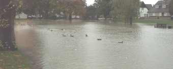
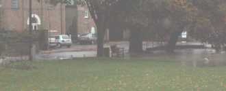
Floods - 21st October
Heavy and continuous rain lead to flooding where drains and ditches couldn't cope. In some places, the problems got worse as the day wore on, whereas in a few others the water managed to drain away.
Residents in South Road, Impington and some in Station Road, Histon had to be evacuated when floodwaters entered their homes.
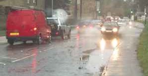 |
Floods in Glebe Way at about 1 pm. There was worse flooding further on the B1049 towards Cottenham, and this got worse as the day wore on. Conventional saloons were forced to use the centre of the road, which was effectively reduced to single width. |
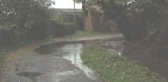 |
Clay Close Lane at 4pm. Not (at this stage) as bad as last year, when local residents had to be supplied with sand-bags to keep floodwaters out of their homes. Nevertheless, deep enough to trap the unwary. |
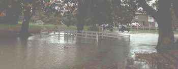 |
The Green at 4pm. The footbridge completely underwater. Residents in the background "enjoying" a walk and looking at the problems on the B1049, including a number of minor shunts. |
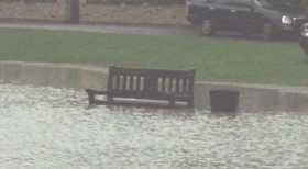 |
The seat on the far (north) side of the Green. Not a great deal of use, except perhaps to the ducks, who weren't too interested. |
 |
The Green, looking towards the Junior School entrance. |
 |
The north western end of the Green, showing flooding into the roadway. |